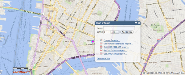
A new map published by the Environmental Protection Agency (EPA) is giving US citizens a more detailed look at the environmental quality of their local neighbourhood than ever before. Statistics for air pollution, water quality, traffic levels and more are all included on the online map, which is freely available for anyone to use.
From the amount of lead paint in the area to the location of the nearest toxic dump, there's plenty of information in the EJSCREEN (Environmental Justice Screen) for those who are interested in researching their nearby area. The idea behind the map is to highlight the problem of using specific areas - usually inhabited by the poorest citizens and people of colour - as dumping grounds for environmental waste.
With this in mind, EJSCREEN charts demographic indicators against environmental ones: you can look up data for those who are of a minority population, in a low income bracket, linguistically isolated, educated below high school level, under the age of 5 or over the age of 64. Charting both types of indicators against each other produces an EJ index - what's more, areas can also be compared against the region, the state or the US as a whole.
"EJSCREEN provides essential information to anyone seeking greater visibility and awareness about the impacts of pollution in American communities," says EPA Administrator Gina McCarthy. "EJSCREEN has been a valuable resource for EPA to advance our commitment to protect Americans most vulnerable to pollution. I'm excited to share this tool with the public to broaden its impact, build transparency, and foster collaboration with partners working to achieve environmental justice."
Of course you don't have to be interested in the EPA's ultimate aims to have a look around your local neighbourhood or a well-known part of the US to check on its environmental quality. The interactive map lets you enter a place name to search for or mark out an area of the map manually. If you need more help interpreting the results as they're shown on screen, then the EPA has provided a helpful guide.
The mapping tool, which is being made available as an ongoing response to a Presidential directive for environmental transparency, is still in the early testing stages. The EPA is welcoming bug reports and feedback on the tool in advance of a more comprehensive version that is scheduled to roll out at some point next year.
Ultimately the Environmental Protection Agency wants to use EJSCREEN to highlight imbalances and act upon them. "EPA uses EJSCREEN as a preliminary step when considering environmental justice in certain situations," it says. "The agency uses it to screen for areas that may be candidates for additional consideration, analysis or outreach as EPA develops programs, policies and activities that may affect communities."
