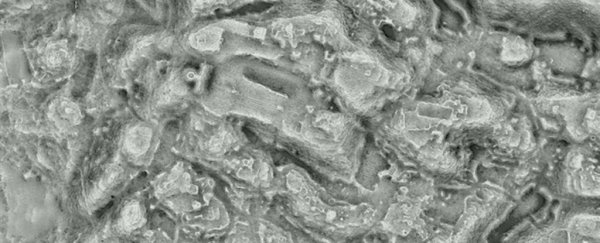
LIDAR is showing its archaeological prowess once again, being used to reveal the extent of a "lost" city in western Mexico built and inhabited by the Purépecha, contemporaneous rivals to the Aztec civilisation.
Led by archaeologist Chris Fisher of Colorado State University, a team has estimated that the city of Angamuco had around 40,000 buildings, spread over an area of 26 square kilometres (10 square miles).
This, the researchers say, is comparable to the number of buildings to Manhattan, over a much smaller area of land - Manhattan spans 59 square kilometres (22 square miles).
Angamuco, which has lain vacant for centuries, has been known about for some time, built over a lava flow that occurred thousands of years ago in the Mexican state of Michoacán. However, attempts to learn more about it have proven difficult, due to the forest that covers it, and the rugged terrain underfoot.
 Angamuco features revealed by LIDAR. (Chris Fisher)
Fisher and his team have been using LIDAR to map the area since 2009, gradually uncovering more and more of the city.
They have mapped 35 square kilometres, revealing the size of the city, with teams on the ground covering 4 square kilometres and confirming over 7,000 architectural features previously identified in the LIDAR data.
"That is a huge area with a lot of people and a lot of architectural foundations that are represented," Fisher told The Guardian. "If you do the maths, all of a sudden you are talking about 40,000 building foundations up there, which is [about] the same number of building foundations that are on the island of Manhattan."
At its peak, between around 1000 and 1350 CE, the population of the city probably reached around 100,000 people, Fisher said - making it the biggest city in western Mexico at the time, and much bigger than the Purépecha imperial capital of Tzintzuntzan, although probably not as densely populated.
The researchers also noticed that the city had some strange layout features. Temples and open plazas are located in eight places around the edges of Angamuco, rather than the centre, as is more usual.
Other features that the team has uncovered includes roads, pyramids, garden areas, ball courts and cemeteries - the latter of which has yielded interesting information about Purépecha funerary practices.
Other artefacts excavated from the city put its earliest date at around 900 CE based on radiocarbon dating, and show that it went through two periods of expansion and one of collapse before the arrival of the Europeans in the 15th century heralded the collapse of the Pre-Columbian Mesoamerican cultures.
LIDAR has previously revealed some absolutely jaw-dropping information about cities lost to forest growth. Earlier this month, researchers working with the PACUNAM Foundation revealed a megalopolis hidden in the jungles of Guatemala.
It has also been used to find medieval cities hidden by the jungles of Cambodia, and Fisher has also previously discovered lost cities in the Honduran rainforest.
This is because LIDAR ("laser" and "radar") can penetrate foliage and water to map the ground below in three dimensions - picking out details that are invisible to the human eye from the air.
"Everywhere you point the lidar instrument you find new stuff, and that is because we know so little about the archaeological universe in the Americas right now. Right now every textbook has to be rewritten, and two years from now [they're] going to have to be rewritten again," Fisher said.
"Many of these areas of the Americas that we see today that we think that we would classify as pristine tropical forests are really abandoned gardens."
Fisher presented the team's research to date at the annual meeting for the American Association for the Advancement of Science in Austin, Texas last week.
