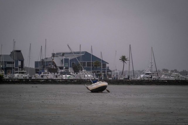
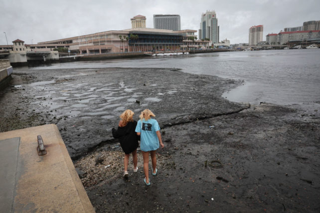
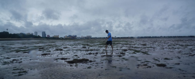
As Hurricane Ian made landfall in Florida on Wednesday afternoon and residents braced for what could be days of threatening weather, the shallow estuary of Tampa Bay on the state's west coast was eerily transformed into a vast mud flat.
The levels were so low in parts that the floor of the usually-bustling harbour was not only visible, people could walk across it. The same phenomenon was seen on harbours and beaches up and down the west coast of Florida.
In Tampa Bay, the water dropped as much as 1.8 metres (6 feet).

But venturing out to explore the low tide is the opposite of what you want to be doing in this situation, experts warned.
The water being sucked out of these harbours is a result of something called 'reverse storm surge' – and what goes out, will eventually come rushing back in.
So why does a powerful hurricane like Ian, typically responsible for delivering huge amounts of water, suck water away from a beach or harbour?
It's all to do with the direction of the wind.
🚨 STOP: Do not walk out into receding water in Tampa Bay or Charlotte Harbor - the water WILL return through storm surge and poses a life-threatening risk.
— FL Division of Emergency Management (@FLSERT) September 28, 2022
Depending on where you stand in relation to a storm's spinning vortex of winds, its powerful air pressure can force the sea level to rise, causing devastating storm surges, or – as in this case – draw water away, leaving entire harbours, bays, beaches and estuaries bone dry.

Because Hurricane Ian is in the northern hemisphere, it's swirling counter-clockwise. Approaching Florida from the south, its winds pushed water away from the coast.
Later, once the storm has passed through, winds in its eastern and lower half are expected to create differences in pressure that channel water inland.
.@NOAA's #GOESEast satellite is continuing to closely monitor #HurricaneIan as the sun sets over the southeastern U.S. #Ian remains a major Category 3 #hurricane as of 8 pm EDT tonight.
— NOAA Satellites (@NOAASatellites) September 29, 2022
Get the latest: https://t.co/FYrreOueMf #FLwx https://t.co/6CSOxUyngo pic.twitter.com/RxbexVRK7l
This has happened before, such as when Hurricane Irma made landfall in 2017, but rarely this dramatically.
"(The winds) acted to push the water out, just the opposite as if a storm was coming in that would push the water up on shore," said Bay News 9 meteorologist Josh Linker back in 2017 when reporting on Irma.
Check out all that lightning in #HurricaneIan’s eye wall. The lightning can be seen thanks to the Geostationary Lightning Mapper on GOES-16. ⚡️@foxweather pic.twitter.com/f8ZjjMhAZ5
— Heather Brinkmann (@WeatherHx) September 27, 2022
Florida Governor Ron DeSantis says the flooding in some areas has already hit 3.6 metres (nearly 12 feet) – these types of surges can be life-threatening.
"Water accounts for about 90 percent of the direct deaths" from US hurricanes, says the National Hurricane Center.
It remains to be seen how much worse the damage will be overnight. Stay safe, everyone.
