Lightning, for all its ubiquity here on Earth, is still a relatively poorly understood weather phenomenon. We know more or less how it happens, but there's so much about its finer intricacies that we're still learning.
But with a new observatory orbiting our world, we have another opportunity to understand these powerful blasts of electricity – and with it, a way to better predict the emergence of severe storms that put lives and infrastructure at risk.
Pperated by the European Space Agency, this 'Lightning Imager' sits aboard the Meteosat weather satellites operated by European Organization for the Exploitation of Meteorological Satellites (Eumetsat).
We've just been treated to its first video releases of lightning across Europe, Africa, and the Atlantic Ocean, and it's certainly eye-opening.

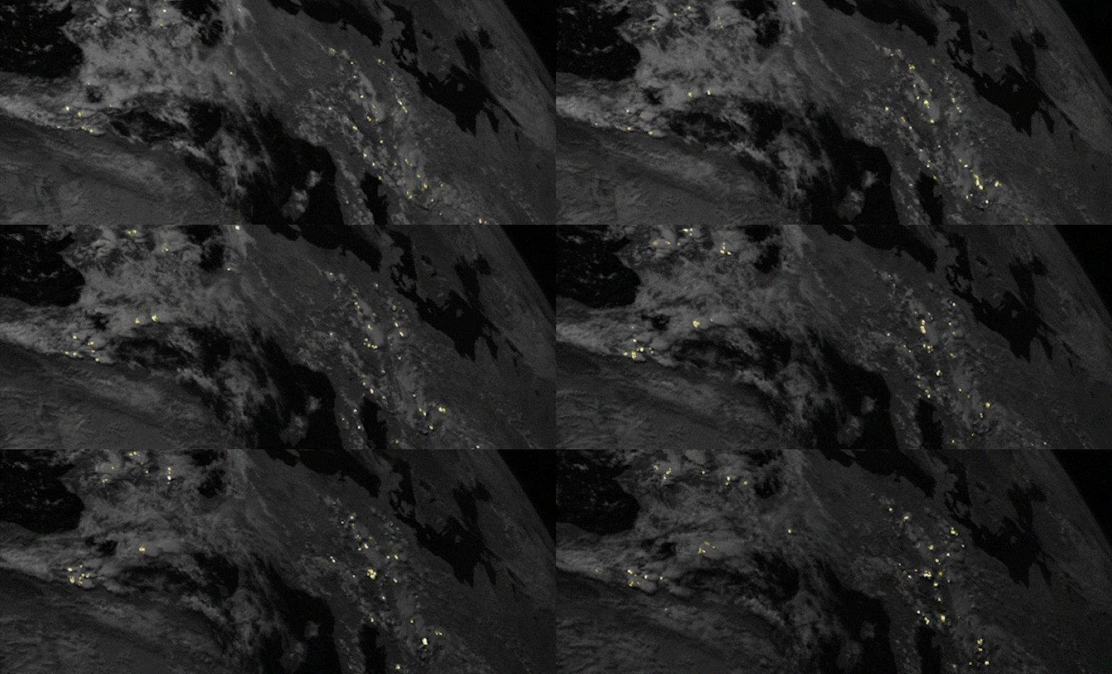
Lightning Imager consists of four cameras, covering Europe, Africa, the Middle East, and parts of South America, and can capture data at a rate of 1,000 frames per second. Each of the newly released videos is an animation that displays a series of images taken by the instrument, combining a time lapse of lightning strikes with a picture of Earth.
"Severe storms are often preceded by abrupt changes in lightning activity. By observing these changes in activity, Lightning Imager data will give weather forecasters additional confidence in their forecasts of severe storms," says Phil Evans, director general of Eumetsat.
"When these data are used in conjunction with the high-resolution data from the Flexible Combined Imager, weather forecasters will be better able to track the development of severe storms and have a longer lead-in time to warn authorities and communities."
Perhaps most striking (ha ha) is the video of Central Africa, among the most lightning-prone regions on the planet. Against the relative darkness of Earth's surface, lightning strikes practically shimmer across the roiling clouds, showing five days' worth of data in just two minutes.
The data so far is only preliminary and not suitable for operational purposes yet, but the animation shows that lightning is fairly constant in the region, with more during the afternoon and evening. And it shows a variety of storm activity, too, from small, isolated storms to large-scale storm systems.
The North camera faces Europe, where thunderstorms are seen developing daily around the Mediterranean in early June, forming as the Sun heats up the ground and clearing up after sunset.
The video also shows larger, more persistent storm systems in West Africa, while the rest of Europe remains relatively cloud-free due to a high-pressure system during the time data was collected.
Finally, the third video shows storms over the Atlantic Ocean, with parts of Africa and South America. This camera covers a part of the world called the Intertropical Convergence Zone, a belt that circles the globe near the planet's equator where the hemispheric trade winds come together. These converging winds create the perfect conditions for storms, and they rage there almost permanently.
The video shows these storms slowly moving across the globe from East to West over a five-day-period. If conditions are right, these storms can turn into tropical hurricanes.
The data will help scientists better predict weather, analyze weather phenomena, and improve air safety, the team says.
You can see more animations here on the ESA website.
