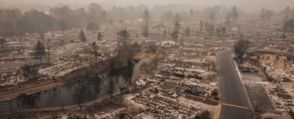
More than half of all buildings in the United States are situated in hazardous hotspots, prone to wildfires, floods, hurricanes, tornadoes, and earthquakes, according to new research.
Areas vulnerable to such natural disasters make up only one-third of the US mainland, and yet most modern development to date has occurred in these very spots.
In 1945, roughly 173,000 structures, including homes, schools, hospitals, and office buildings, were situated in hotspots for at least two separate kinds of natural disasters.
Seven decades later, that number has now reached over 1.5 million buildings, and development in these areas is still growing rapidly.
"We know that climate change is increasing the risk of damage from some natural hazards," says climate scientist Virginia Iglesias from the University of Colorado Boulder.
"But are losses also increasing because of the way that we are developing our cities, our towns?"
Unfortunately, the answer to that question appears to be yes. In fact, urbanization, rather than climate change, was found to be the main cause of structural losses from natural disasters.
Nor is it just cities and their residents that are exposed. Losses can ripple outwards, spreading supply-chain disruptions, business closures, unemployment, and displacement to rural areas as well.
When researchers built a map of hazard hotspots on the US mainland and compared these zones to historical land development, they found a worrying overlap.
Despite recent efforts to better identify where natural disasters are likely to occur, we are still building far too many structures in known hazard zones. And that's before we take into account the impact of climate change on natural disasters.
 (Inglesias et al., Earth's Future, 2021)
Above: Hotspots of high exposure to earthquakes (magenta), floods (cyan), hurricanes (grey), tornados (yellow), and wildfires (orange).
The density of structures prone to earthquakes and hurricanes appears to have increased the most. Compared to development in the rest of the country, buildings in hurricane-prone areas have shot up three-fold since 1945.
This means far more people will likely be exposed to hurricanes in the future, especially as climate change increases the storms' intensity and frequency. The risks are mostly confined to the east coast and states around the Gulf of Mexico, where hurricanes are particularly common.
In 2017, for instance, Hurricane Harvey struck Texas and Louisiana, resulting in 75,000 building-related insurance claims. The destruction hit the poorer areas the hardest. Many disadvantaged groups were displaced from their homes and received little assistance.
"Vulnerability matters. There's evidence that natural disasters exacerbate socioeconomic inequality," explains Iglesias.
"If we want to make decisions that effectively increase the ability of communities to cope with natural hazards, we need to know where vulnerable populations live, and the specific hazards they're exposed to."
Cities and towns on the west coast, for example, are more at risk of earthquakes and wildfires than hurricanes. Los Angeles County alone accounts for up to 22 percent of all yearly earthquake damage in the US, researchers say.
Of course, many new structures along the West Coast are being built with earthquakes in mind, which means they will be less vulnerable to shaky ground than older buildings that have not been retrofitted.
Still, not all our countermeasures to natural disasters actually reduce the risk of exposure, destruction, or death.
Floods were found to cause more property damage than any other natural hazard on the US mainland. But while far fewer houses are being built in floodplains today, the construction of levees to contain or alter the flow of water has meant some hazardous areas have been removed from federal designations of flood danger.
More houses are therefore being built near these levees, and yet in places like the Sacramento-San Joaquin river network, flood control structures actually increase flood risk while at the same time making people feel less at risk.
Levees, after all, can work to contain most floods, but they don't reduce the risk of extreme flooding events that might occur every hundred years or so.
Similar to wildfires, these extreme events are likely to increase in intensity and frequency with climate change, putting more and more communities at risk – even those that think they're safe.
Between 1992 and 2015, an average of 2.5 million homes were within a kilometer of a wildfire every year.
"These critical levels of exposure are the legacy of decades of sustained growth and point to our inability, lack of knowledge, or unwillingness to limit development in hazardous zones," researchers warn.
"Development in these areas is still growing more rapidly than the baseline rates for the nation, portending larger future losses even if the effects of climate change are not considered."
Where we place our buildings already matters a lot, and it will matter much more as our environment continues to change rapidly.
The study was published in Earth's Future.
