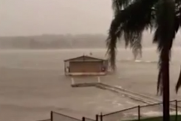
If you're like me and you're sitting indoors listening to the squalling winds and relentless, pouring rain that's been bombarding Sydney for two days now, thanking your lucky stars that you're fortunate enough to have an indoors to sit in, it'll probably make sense to you when I say that at some point yesterday, the wind met tropical cyclone criteria.
While we can't technically call what happened yesterday a tropical cyclone, the news does confirm that what's happening outside right now is actually pretty extraordinary. "From the wind statistics you can see that the Tropical Cyclone criteria for a sustained one-minute wind gust has been met," senior climatologist at the Australian Bureau of Meteorology, Agata Imielska, told Peter Hannam at The Sydney Morning Herald. "The more important point here is that the winds are damaging. Generally a threshold wind gust of 90 km/h or more is used to define damaging winds."
Along with incredible activity in the coastal waters surrounding Sydney - the highest wave so far hit 13.6 metres - residents were also bombarded with more than 119 mm of rain yesterday, which is the most we've had on a single day since February 2002. Add gale force winds to the mix - the town of Norah Head experienced speeds of 135 km/h before 5am on Tuesday - and we've got ourselves some real indoors weather.
"[The winds] have been consistently gale force. Gale force is the threshold for being Cat-1," Rob Sharpe, a meteorologist at Weatherzone, told Hannam. Cat-1 - short for Category 1 - refers to a type of tropical cyclone that typically results in negligible house damage, but some damage to trees, crops, and vehicles. Gale force winds with speeds over open flat land of 90 to 125 km/h must be involved.
But while the wind statistics technically meet the criteria for a tropical cyclone, no one's quite ready to classify what we're currently going through as such. This is because while tropical cyclones are known to originate close to the equator, building their strength in the warm, tropical waters up north, the storm hitting Sydney is the result of a bunch of different kinds of events coming together at the right place and the right time.
Peter Hannam explains at The Sydney Morning Herald:
"For the current event, a relatively weak low-pressure trough on the coast was joined by 'a really pronounced upper level trough' of cold air that had moved in from Victoria, Mr Sharpe said. 'Those two systems then combined and we saw that [cyclonic] rotation,' Mr Sharp said. 'That rotation was created with the warm moist air along the coast interacting with the really cold upper level air inland.'
The strength of the current event was driven by the steep gradient between the warm over the Tasman and cool air at upper levels of the atmosphere, making for a classic east coast low set-up."
Hannam adds that around this time of year is when temperatures on the surface of the ocean are at their warmest, and this year, they've been unusually high. This could explain why everything's added up to an abnormally powerful storm system.
According to Business Insider, the State Emergency Service (SES) has so far carried out 40 flood rescue operations and received more than 4,500 calls for assistance. Three elderly people have reportedly died due to the extreme conditions. The SES says they don't expect conditions to ease till at least later today.
Keep safe, everyone.
Sources: The Sydney Morning Herald, Business Insider
