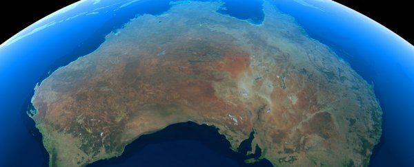
Scientists have discovered that the Australian continent is shifting back and forth several millimetres every year, because of changes to Earth's centre of mass.
In fact, this centre of mass is changing every single season, which means the entire Australian continent is moving its position slightly twice a year.
Earlier this year, researchers confirmed that Australia had moved 1.5 metres north over the past 22 years due to tectonic shifts, and the government will be officially updating the country's latitude and longitude to reflect the change.
But the new study shows that, in addition to this gradual northward drift, the continent is regularly wiggling back and forth throughout the year, because of changes to Earth's centre of mass.
The centre of mass is the average position of the mass of an object, and for Earth, it lies roughly at the centre of the planet's molten core - around 6,000 kilometres (3,700 miles) below the surface.
But it's not always in the same place - as the distribution of water changes across Earth's surface from summer to winter, the planet's centre of mass also shifts a few millimetres in different direction.
That slight shift in centre of mass affects all continents very slightly, but because of its position between Europe and the South Pacific Ocean, Australia moves the most, the team explains.
"[Water] migrates every season," said lead researcher Shin-Chan Han, from the University of Newcastle in Australia. "That motion causes quite a detectable, sizeable deformation in Australia."
To figure out how much the continent was moving, Han and his team monitored changes in the locations of 14 land-based GPS stations across Australia, which can pick up changes in land position of less than 1 millimetre.
They then compared their results with satellite data on Earth's gravitational pull throughout the year, which allowed them to measure where water was across the planet.
What the team found was that every Northern Hemisphere winter (Australian summer) - when snowpack in the Northern Hemisphere is at its peaks - the weight of all that frozen water is strong enough to move Earth's centre of mass a few millimetres closer to Europe.
That causes the Australian continent to move northwest by about 1 millimetre, and its northwestern edge to tilt downwards by 2 to 3 millimetres, while the southeastern edge lifts up the same amount.
During Northern Hemisphere summer (Australian winter), the opposite occurs as all that ice returns to the atmosphere through evaporation.
 Shin-Chan Han
The shift is too subtle to be felt - this is all pretty minuscule stuff over the scale of an entire continent.
But it's a significant enough change to affect satellite measurements, and the team suggests that GPS measurements are likely a millimetre or two off in Australia already.
That might not sound like a big deal, but is when we rely on GPS measurements to track things like rising sea levels, or self-driving cars.
The team is now hoping they can use their research to make GPS more accurate.
"If our [GPS] station has some systematic distortion - deformation - it will impact our precise positioning calculation," said Han. "So we need to know any systematic bias in our station to better understand our position."
The results have been published in The Journal of Geophysical Research, and need to be replicated by independent teams before we make any major changes to GPS.
But other researchers are already excited about the new approach, which can be used to double check other planetary measurements - and should also work on other continents.
"This new way of determining the Earth's [centre of mass] … is a new and novel approach and will be taken up by others," said Richard Gross, a researcher at NASA's Jet Propulsion Laboratory in Pasadena, California, who wasn't involved with the study.
